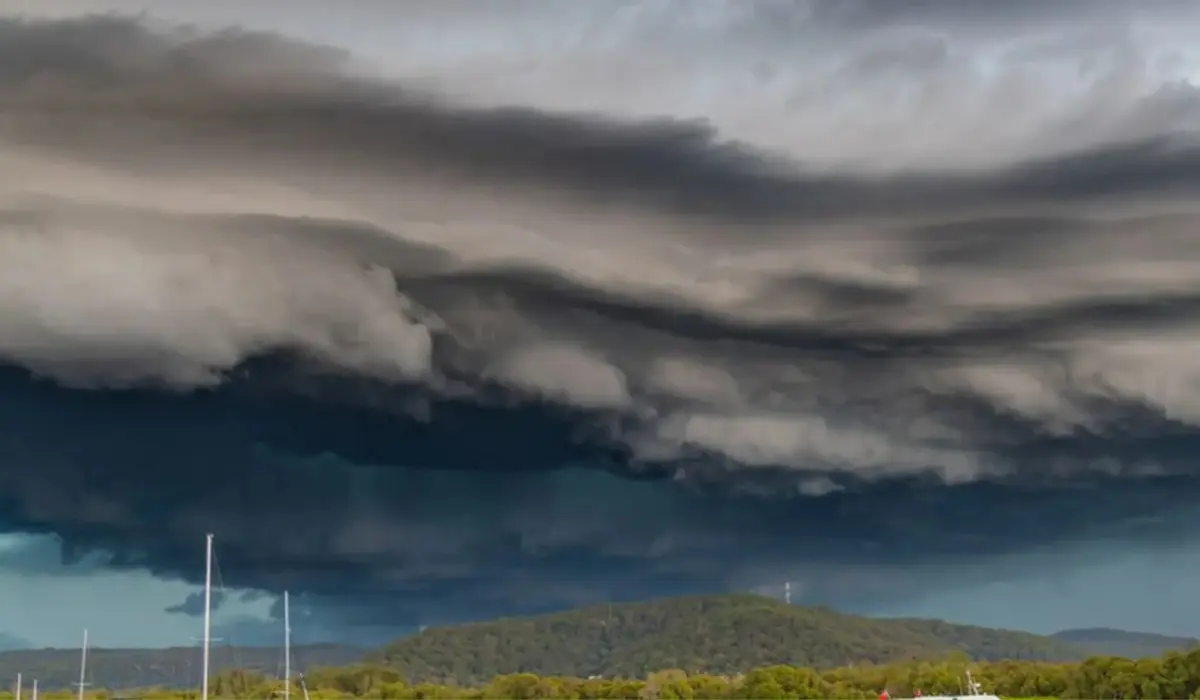
Thousands of residents across South-East Queensland were left in the dark on Saturday night as powerful thunderstorms swept through the region, unleashing large hailstones and damaging winds that cut electricity to thousands of homes.
By 9:45 p.m., more than 4,800 properties had lost power across multiple council areas, including the Gold Coast, Logan, and Moreton Bay.
Outages also extended north through the Sunshine Coast and Gympie, west to the Somerset region, and even into parts of Brisbane, according to energy provider Energex.
The Bureau of Meteorology (BoM) had warned earlier in the day that severe thunderstorms were highly likely across the state’s south-east, with the potential for large hail and destructive gusts. Their forecast proved accurate as the system intensified late in the afternoon.
Also Read: 3 financial practices that boost success for beginning farmers
Giant hail and fast-moving cells
The first reports of significant hail came from Samford, northwest of Brisbane, where residents recorded stones measuring up to five centimetres in diameter around 4:30 p.m. Similar hail was later reported in Caboolture just after 5:00 p.m., prompting fresh warnings from authorities.
Radar imagery that evening showed multiple storm cells moving rapidly across the region. By 5:50 p.m., thunderstorms had been detected near Cleveland, Caloundra, Somerset Dam, and the NSW border. The BoM said the storms were expected to reach coastal towns, including Noosa Heads and Maroochydor,e shortly after 6:00 p.m.
A particularly dangerous cell was detected earlier in the afternoon near Boonah in the Scenic Rim. Meteorologists warned it was capable of producing “giant hailstones” and “locally destructive winds,” particularly in the communities of Rathdowney, Laravale, and Kooralbyn.
Widespread damage and safety warnings
Energex crews began mobilising to assess and repair damaged power lines once conditions eased. The company urged the public to keep well clear of fallen lines and to report any hazards immediately to emergency services.
“Safety always comes first,” the company said in a public notice. “Our teams will begin restoration work as soon as it’s safe to do so. We’ll update our outage finder as soon as assessments are complete.”
Emergency hotlines were inundated with reports of downed trees, damaged roofs, and blocked roads as the storms crossed the region in quick succession. Local councils issued safety reminders urging residents to stay indoors until the system had passed.
Meteorologists monitor the storm belt
BoM senior forecaster Baden Gilbert said the volatile conditions stretched from the coast to inland towns such as Toowoomba and north to Rainbow Beach. He noted that the greatest threat zone was concentrated in the south-east interior, including Boonah, Beaudesert, Ipswich, Esk, and Kilcoy.
“These are the areas most at risk of destructive wind gusts and large hail,” Gilbert said. “If a strong storm cell develops in the right conditions, we could even see giant hail or short bursts of very heavy rain.”
Gilbert explained that the severe weather was driven by a trough system extending across Queensland’s southern interior, which shifted eastward throughout the day. The system was expected to move offshore overnight, allowing conditions to stabilise by Sunday morning.
A brief reprieve before the heat returns
Despite the storm’s intensity, meteorologists don’t expect a long-lasting wet spell. Once the trough moves out to sea, the region is forecast to enter a dry stretch lasting through much of the coming week.
Sunday is expected to bring cooler temperatures following Saturday’s humid build-up, but by midweek, the heat will return sharply. Gilbert warned that Brisbane could reach 35 degrees Celsius by Thursday, while Ipswich may climb close to 39 degrees.
“It’s a bit of a rollercoaster week,” he said. “Storms one day, cooler air the next, then we’re heating right back up.”
Communities left cleaning up
For residents, Saturday’s storms were a harsh reminder of the destructive potential of Queensland’s spring weather. Social media quickly filled with images of golf ball–sized hailstones blanketing yards and shredding trees. Many residents reported roof leaks and smashed car windows after the sudden onslaught.
While power restoration crews continue to work through the affected areas, authorities have urged patience, warning that some repairs may take time due to widespread damage. With more than 4,800 homes cut off at the peak of the storm, Energex said it was prioritising critical services and high-density residential zones.
The Bureau of Meteorology’s latest updates indicate that storm activity should ease overnight as the trough passes offshore. However, residents are being reminded to remain alert to any further warnings and to keep emergency numbers handy in case of fallen power lines or flash flooding.
As Queenslanders clean up from another burst of severe weather, authorities are using the event as a timely reminder to review storm preparedness ahead of the summer season. With hotter days on the horizon and a history of unpredictable systems, Saturday’s outbreak served as a sharp warning that storm season is well underway.
